On foot between paths and springs
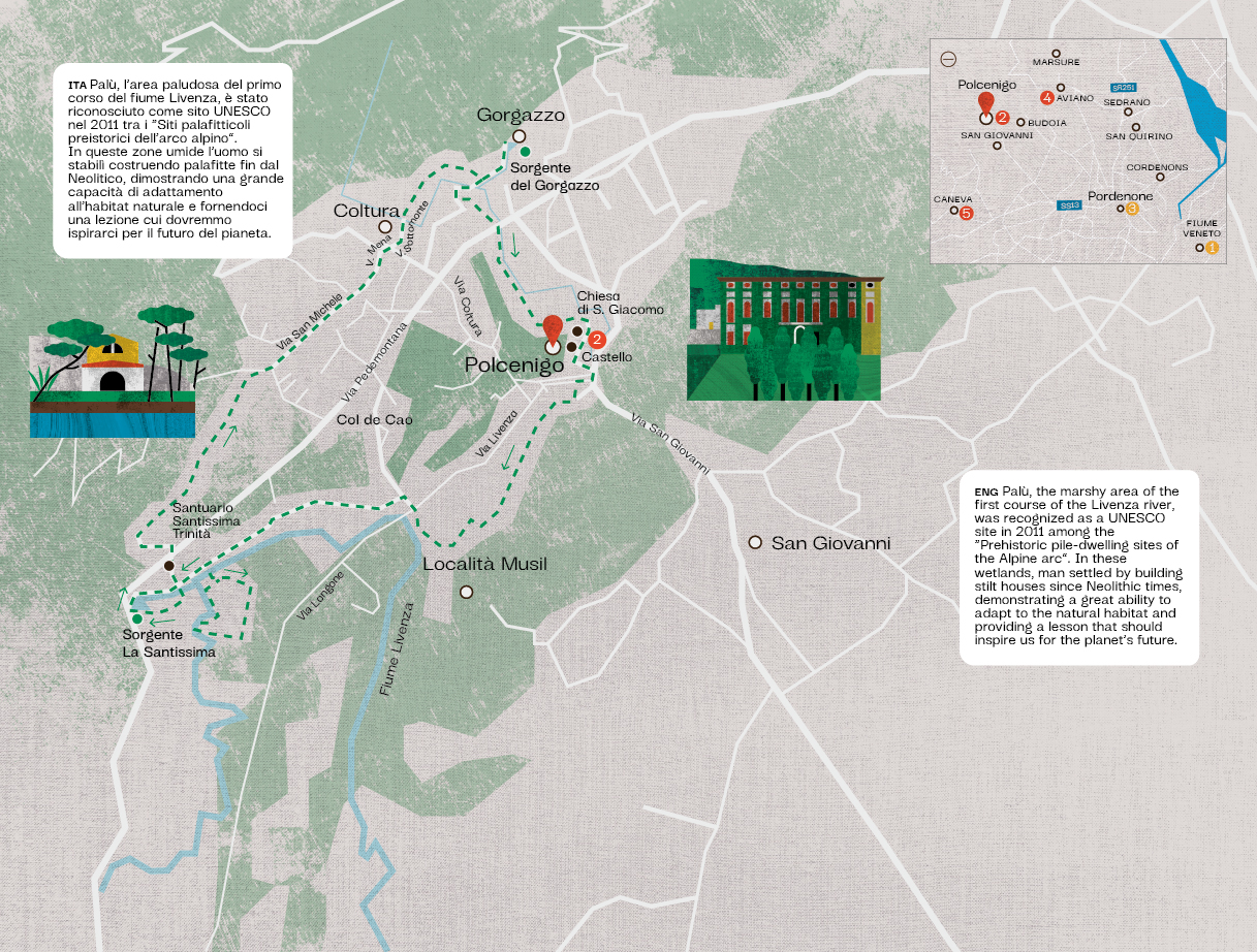
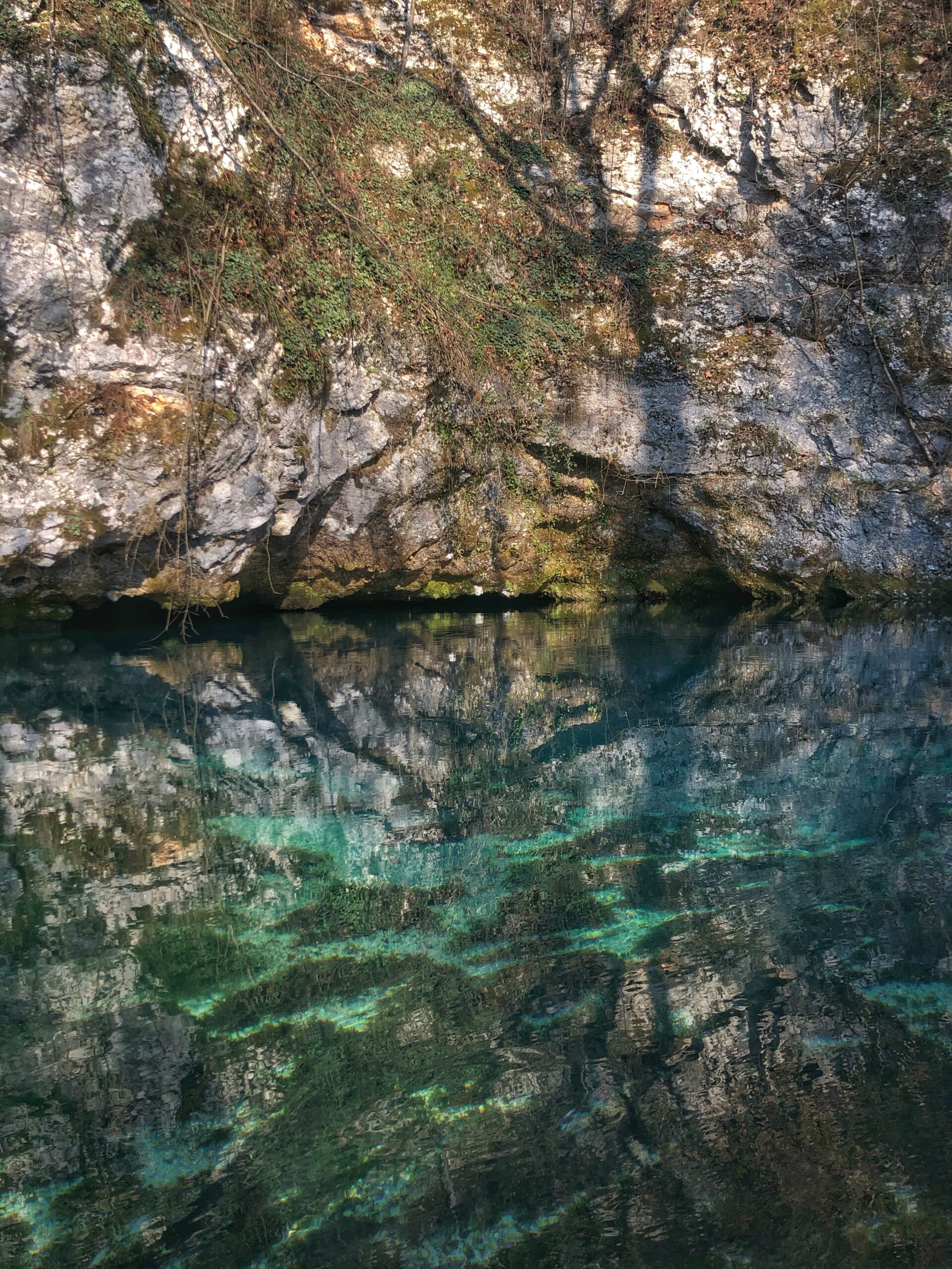
The particular geographic location between the Cansiglio ridge and Col Longone, together with the fertile soil and abundance of woods and game have made it an ideal place for human settlement dating back to very ancient times. The itinerary starts from the car park in the locality of Santissima, in the Municipality of Polcenigo, not far from the Sanctuary of the same name dedicated to the Holy Trinity and the main source of the Livenza River, which can already be seen in front of you. Bring comfortable hiking boots, possibly waterproof if it has rained recently. Some short sections of the route may be slippery. With the car park behind you, head to the left and soon thereafter take a small, marked path to the right that will lead you into the archaeological area. After a small bridge over a sluice, you will find a loop trail that you can start either from the right or the left. Along the way you will find some interesting information panels, but please remember not to expect to see remains of pile dwellings or other archaeological finds. Most of the ones brought to light are in the archaeological museum in Torre di Pordenone, while many others are still underground. Once you have completed the loop, return to the car park and head towards the Sanctuary: an ancient place of worship which was documented as early as the first half of the 14th century but which is certainly considerably more ancient in origin. It has always been a place of pilgrimage associated with rituals meant to bring fertility or rain. Directly opposite, a wooden bridge leads you to the other side of the river, and by following the short path to your right you will arrive at its main spring: water gushes out in great volume from under the road, as if by a miracle. Fill your senses with all this beauty and also try to feel the energy that is released from this place, you will feel regenerated. Now circle the spring and complete the loop trail back to the shrine. On the right, you will come across a small building containing the machinery of an aqueduct dating back to 1900 and a small votive shrine dedicated to the Immaculate Conception built on a small resurgence spring whose water has always been considered to have the power to work miracles. When you arrive at the church, take the first road on the left that climbs up towards the provincial road, cross it and continue uphill in the same direction for about 200 metres, turn right in the vicinity of a house and take a path that winds its way through groves and old terraced plots of land, leading you to the village of Coltura. Here, continue in the same direction on an asphalt road for about 1 kilometre, following Via S. Michele, Via Al Mena, and Via Sottomonte in this order. At the end of the latter, there is a small square from which two roads branch off. Take the second on the right and follow it through a small wood. Keeping to the right, in a few minutes you will reach the hamlet of Gorgazzo, and if you are lucky, you will immediately see the rushing crystal-clear waters of the stream of the same name in front of you; unfortunately, water is not guaranteed here in all seasons, and you will soon understand why.
This is a karstic spring, which is also known as an “overflow” spring; it is shaped like a slightly sloping funnel and several tunnels branch off in its depths. Since the 1960s, it has been explored by cave divers from various European countries and the maximum depth reached so far is an impressive 222 metres, making it the deepest spring explored by man in Italy! Return to the path by retracing your steps. Cross the small bridge again and follow Via Giuliana to the end of the first group of houses. On the left you will see a beautiful green meadow: leave the road and take the short path that borders the meadow in its initial stretch and then heads towards the road at the foot of the mountain, reaching the Gorgazzo stream once again. Cross the road and re-join the path on the other side. Still following the course of the stream, you will also pass through an enchanting grove of mosses and ferns just before emerging next to the parish church of San Giacomo in the historic centre of Polcenigo. Turn right at the side of the church until you reach the square directly in front of it. A majestic cedar of Lebanon stands just outside the entrance, and next to it is what remains of an ancient Franciscan monastery, of which there are records dating back as far as the year 1262. You can now choose whether to head up to the castle and enjoy the view from above (10 minutes) or descend directly towards the village for a rest stop. As soon as you descend go left to reach the main square crossed by the Gorgazzo stream and if there is plenty of water, look for its beautiful waterfalls nearby.
Do not cross it, instead descend the steps in front of you and cross the small brook that flows into the Gorgazzo stream. At this point, all you have to do is follow the path along the Gorgazzo stream while keeping to the right until you reach a bridge. Cross it, proceed until you meet the Livenza river in front of you, turn right to the asphalt road, and after crossing it, continue for about one kilometre in the same direction until you reach the car park.


